ShareThis

Wednesday, October 29, 2014

Working to Improve Access on the Upper Delaware River

Delaware Highlands Conservancy Launches Fundraising
Campaign for River Access in Long Eddy, NY

Hawley, PA and Bethel, NY— Hours of community input are coming to
fruition as the next phase of the Sullivan County River Access Plan, an initiative
which has engaged and activated the community, is now being initiated.

As Sue Currier, Executive Director for the Delaware Highlands Conservancy,
explains, “The Conservancy is honored to be helping to implement a plan that
Sullivan County and the community developed to revitalize river communities,
enhance our economic vitality, and develop a coordinated, cohesive approach to
branding the county’s river accesses. As a result, we’re coordinating a
fundraising campaign to make this next phase happen, beginning with the Long
Eddy river access.”

The purpose of the fundraising campaign is to purchase, protect, and improve
the fishing and boat access site to the Delaware River located in Long Eddy,
Sullivan County, NY.

At present, the Long Eddy access is popular with river guides and recreational
users, but does not have a ramp or sufficient parking. The resulting crowded
conditions reduce use by all but the most determined, and create conflicts over
inappropriate parking with the nearby residents and businesses. The recently
completed Sullivan County River Access Plan has identified the need to enhance
access to the Delaware River for recreational enthusiasts and provide additional
economic lift to our river towns, such as Long Eddy.

The Delaware Highlands Conservancy has signed a contract to acquire a piece
of private property located along the Delaware River, adjacent to the existing
road used as the boat launch. It will be conveyed to the NYS DEC, who will in
turn improve the boat launch for all river users.

The purchase, holding, and subsequent transfer of the property will cost
approximately $20,000, and the Conservancy is hosting a fundraising campaign
to cover these costs. The campaign may be accessed via Indiegogo at
https://www.indiegogo.com/projects/improve-the-long-eddy-river-access or more information is available on the Conservancy’s website at http://www.DelawareHighlands.org. Every dollar donated goes
directly to the project and, in turn, benefits the local community, its businesses,
and all river users.

As Jeff Graff, an avid fly fisherman, explains, "The Delaware River is a truly
amazing natural resource and a fly fisherman’s dream. It’s clear, clean waters
flow over cobble bottom long eddies and riffles that meander through the
ancient, dark hills and hardwood forests of southern New York and northeastern
Pennsylvania and hold abundant populations of healthy, wild rainbow and
brown trout. Its prolific aquatic insect hatches of mayflies, caddis flies and
stoneflies provide some of the best and most challenging fly fishing
opportunities for fishermen in the United States.”\

He continues, “Creating and maintaining access to the river is essential, not only
to fishermen interested in ensuring that the fishery remains vital and accessible
to drift boats and wade fishermen, but also to other recreational users of the river
such as canoeists and kayakers."

The Delaware Highlands Conservancy works with landowners and communities
to protect the healthy lands, clean waters, eagles and other wildlife, and
sustainable economies of the Upper Delaware River region. For more
information, send an email to info@delawarehighlands.org or call 845-583-1010

Monday, September 15, 2014

Future of the Upper Delaware River Conference

Water Water Everywhere – Future of the Upper Delaware River Conference
October 14-15, 2014, 10 am – 4 pm
Hosted by Friends of the Upper Delaware River

Register Now for the 5th Annual WWE Conference!

This year’s 2-day conference will be our largest ever with expert speakers who will comprehensively address all of the pressing issues facing the Upper Delaware River.  The event is also a time to reconnect with old friends, network with partners and allies, and socialize on the banks of the beautiful West Branch of the Upper Delaware River during peak foliage season.

Conference Fee:  $35/day $60/two days – includes meals (lodging not included)
Early Bird Special – Paid Registration by September 15 – $30/day $50/two day

Wednesday, August 20, 2014

Paddlers & Boaters Reminded to Obtain Launch Permits

As summer winds down, paddlers planning kayaking and canoeing trips are reminded that a launch permit or boat registration is required to use access areas owned by the Pennsylvania Fish and Boat Commission (PFBC) and at state park and state forest access areas operated by the Department of Conservation and Natural Resources (DCNR).
 
“The popularity of unpowered boats, including canoes, kayaks and stand-up paddleboards, is growing in the Commonwealth and nationwide,” said Corey Britcher, Director of the PFBC Bureau of Law Enforcement. “This is great for the sport and we’re glad people are engaged in outdoor activities.”
 
“With more people using Commission access areas, we want to remind them that a launch permit or boat registration is required,” he added. “Boat registrations and permit sales generate funds for the continued maintenance of these facilities and for boating safety programs and services.”
 
PFBC launch permits cost $10 for one year or $18 for two years.
 
Users can also choose to register their unpowered boat for $18. Boat registrations are issued for 2-year periods and expire on March of the second year.
 
PFBC launch permits and boat registrations are also valid in state parks and state forests. Users can also purchase a DCNR launch or mooring permit, which is valid at PFBC properties. Visit the DCNR website for more information.
 
Paddlers using PFBC access areas without valid launch permits or boat registrations are subject to a $75 fine.
 
Launch permits are available online through the PFBC’s Outdoor Shop, at PFBC region offices, authorized issuing agents and many state park offices. More information is available by calling the PFBC’s toll-free registration hot-line 866-BOATREG (866-262-8734) or by visiting the PFBC website.

Saturday, May 17, 2014

Upper Delaware BioBlitz

Second Annual Upper Delaware BioBlitz to Occur in Sullivan County

UPPER DELAWARE REGION – Families can take advantage of a special educational opportunity for all ages to experience the diversity of life on a unique parcel of private property. The second annual Upper Delaware BioBlitz will occur on Saturday, June 28 and Sunday, June 29, 2014. This event is free to the public.

During this event, biologists and volunteers will gather to identify as many living things as possible within 24 hours on a demarcated parcel of about 200 acres within the Ten Mile River Scout Camp in the Town of Tusten, Sullivan County, NY. Collection will start at noon on Saturday and continue until noon on Sunday.

The public is invited to tour the site from 9:00 am to 3:00 pm on Sunday. For free, families can view the specimens, talk to experts, and enjoy a tour of the site to learn how different species live and thrive in the context of the overall property. Teams and sponsoring organizations will provide information and offer educational programs on their particular areas of expertise. The public should attend for an opportunity to meet scientists of different disciplines, see what they have collected and take a tour of the site.

“This exciting event highlights the richness of the environment in which we play, work and live and helps us see our lives in the context of all the other living things with which we co-exist,” says BioBlitz organizer, Steve Schwartz.

A BioBlitz is an event where teams of scientists gather on a demarcated property for 24 hours to collect, identify, and catalogue every single species they can find visible to the naked eye. The latter part of the event is open to the public for youth and their families to meet the scientists, see what they have collected, and learn more about biology in the context of the site.

Teams of researchers will focus on specific categories of life, including aquatic macro invertebrates, birds, botany, fish, fungi, reptiles and amphibians, invertebrates, mammals, mosses, and lichens. The scientists are asked to identify what they find down to the species level using specialized methods. Some of this will be done in the field either by photos or visual identification. Other items will be brought back to the collection tables for further identification through careful analysis through microscopes and reference material on site.

A portion of this property is within the National Park Service’s Upper Delaware Scenic and Recreational River corridor and borders the river at the Ten Mile River landing. The BioBlitz site will also include the Indian Cliffs, Rock Lake, Mauls Pond, and Grassy Swamp Pond, one of the only quaking bogs to be scientifically authenticated in the Catskills.

According to the University of Connecticut’s website, “BioBlitz is designed to increase the public's awareness of the variety of life in their immediate neighborhood and the services these various species provide to improve the quality of their lives. We usually hear the word "biodiversity" in regard to rainforests with their vast number of species. Yet the diversity of life in our own backyards is phenomenal. We take for granted clean water, fertile soil, and air to breathe. Yet these are all the result of working ecosystems filled with species that perform these tasks. From our morning shower to our late night snack, we are supported by biodiversity every minute of the day. What better way to address the topic than to invite people to share in our 24-hours of discovery and to experience the vast array of species that we can find in their neighborhood park in just one cycle of the day.”

All of the data will be compiled into an inventory of species collected during the event. This information will be publicly available and may help future scientists understand what was living on the site at this particular time, including rare or endangered species. Experts will travel from far distances to study this unique area of New York State.

“It’s an unusual opportunity for scientists and amateur naturalists to share information with the public about their research,” Schwartz adds. “The entire collection of species identified, along with vast biota of microscopic species, are interdependent and nourished by the mineral and organic composition of the soils and the air and water. People experienced in various disciplines working together at this event reflect the interdependence of life in the natural environment.”

Upper Delaware BioBlitz participating organizations include Delaware Highlands Mushroom Society, Upper Delaware Council, Catskill Mountainkeeper, Delaware Highlands Conservancy, Cornell Cooperative Extension Sullivan County, National Park Service, Norcross Wildlife Foundation, Northeast Pennsylvania Audubon Society, The Nature Conservancy, Friends of the Upper Delaware, Sullivan Renaissance and Delaware Riverkeeper Network. The Delaware Highlands Conservancy is the Fiscal Sponsor for the event and all contributions to the event through the Conservancy are tax deductible.

Scientists are participating from Cornell, Penn State, East Stroudsburg University, Academy of Sciences Philadelphia, and other academic, nonprofit and governmental organizations.

In 2013 over 50 scientists and amateur naturalists gathered for the first Upper Delaware BioBlitz on the Norcross Wildlife Foundation’s “Gales Property” at the confluence of the East and West Branches and main stem of the Delaware River. In 24 hours they collected, identified, and catalogued 1,024 unique species of life. Some of the collected species identifications were later confirmed by experts at the New York Botanical Garden and Smithsonian Institution and the insects collected by the Invertebrate team are in the permanent collection of the Academy of Sciences in Philadelphia.

Monday, April 7, 2014

$1 Billion Project to Fix Leaks in Delaware Aqueduct

Department of Environmental Protection Joins Local Officials from the Hudson Valley to Mark Important Progress on the Delaware Aqueduct Bypass Tunnel

Department of Environmental Protection (DEP) Commissioner Emily Lloyd on Friday joined town, county and state officials in Wappinger, N.Y. to mark the next phase of construction at Shaft 6B, a key component of the $1 billion bypass tunnel project that will address leaks in the Delaware Aqueduct. Commissioner Lloyd was joined by Dutchess County Executive Marcus Molinaro, Town of Wappinger Supervisor Barbara Gutzler, State Sen. Terry Gipson, State Assemblyman Kieran Michael Lalor, and Town of Newburgh Supervisor Gil Piaquadio for a ceremonial first blast at the construction site, which marked the beginning of bedrock excavation to build a 700-foot-deep shaft on the east side of the Hudson River.

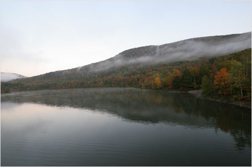
The Delaware Aqueduct conveys more than half of New York City’s high-quality drinking water every day from reservoirs in the Catskill Mountains. DEP has been monitoring two leaks in the aqueduct since the 1990s. The leaks—located in Newburgh and Wawarsing—release a combined 15-35 million gallons a day, depending on the rate of flow inside the aqueduct. To address the leaks, DEP has begun construction of a 2.5-mile bypass tunnel that will run 600 feet below the Hudson River, from Newburgh to Wappinger. The bypass tunnel, which is scheduled to be complete in 2021, will convey water around the leaking portion of the Delaware Aqueduct in Newburgh. That existing part of the aqueduct will be taken out of service once the bypass tunnel is finished. The smaller leak in Wawarsing will be sealed shut by grouting from inside the aqueduct.

The bypass tunnel is the central component of DEP’s $1.5 billion Water for the Future program, which aims to ensure clean, safe and reliable drinking water for future generations of New Yorkers. Water for the Future also includes structural upgrades to the Catskill Aqueduct, rehabilitation of the Queens Groundwater System to supplement upstate supplies, and water conservation initiatives in the City.

“Repairing the Delaware Aqueduct is among the highest priorities for DEP because the aqueduct supplies more than half the drinking water to 8.4 million people in New York City and another million residents upstate,” DEP Commissioner Emily Lloyd said. “That is why I’d like to thank the elected leaders here in the Hudson Valley for working with DEP to help this vital infrastructure project get started.”

The Delaware water supply system originates more than 120 miles north of New York City and comprises four reservoirs: Cannonsville, Neversink, Pepacton and Rondout. The 85-mile long Delaware Aqueduct conveys drinking water from these reservoirs to the City’s distribution system. On average, the Delaware Aqueduct provides more than half of the approximately 1 billion gallons of clean drinking water required to meet the City’s demands every day. The aqueduct, the world’s longest continuous tunnel, was constructed between 1939 and 1944 and crosses Ulster, Orange, Dutchess, Putnam and Westchester counties. The aqueduct runs as deep as 1,500 feet below ground, varies in diameter from 13.5 to 19.5 feet, and was constructed by drilling and blasting.

In most areas, the Delaware Aqueduct is lined only with reinforced concrete. However, two sections of the tunnel that run through limestone formations were lined with steel because limestone is more likely to cause wear and tear on the aqueduct. The ongoing investigation of the structural integrity of the aqueduct has found that small cracks formed where this steel lining ended.

DEP has continuously tested and monitored the leaks by using dye, backflow, and hydrostatic tests, and hourly flow monitors provide near real-time data on the location and volume of the leaks. In 2003 and 2009, DEP used an Autonomous Underwater Vehicle (AUV)—a cutting-edge, self-propelled submarine-shaped vehicle built in partnership with engineers at Woods Hole Oceanographic Institution in Massachusetts—to conduct a detailed survey of the entire 45-mile length of tunnel between Rondout Reservoir and West Branch Reservoir. The AUV took 360-degree photographs while gathering sonar, velocity, and pressure data to assist in determining the location, size and characteristics of the leaks. The AUV is scheduled to launch again in fall 2014 to update that data. All the data gathered thus far clearly show that the rate of water leaking from the tunnel has remained constant and the cracks have not worsened since DEP began monitoring them in 1992.

Repairing Leaks in the Delaware Aqueduct
In 2010, the City announced a plan to address the leaks by building a bypass tunnel around the portion of the aqueduct in Newburgh with significant leaks, and also grouting closed the smaller leaks in Wawarsing. Site work for this complex project began in January 2013 and construction is expected to continue through the year 2021.

The project commenced with the excavation of two vertical shafts that will provide access for construction workers to build the bypass tunnel. The shafts in Newburgh and Wappinger will be 900 and 700 feet below surface level respectively and will measure roughly 30 feet in diameter. Blasting for the shaft in Newburgh began in October 2013. Work in Wappinger began last year with the excavation of roughly 65 feet of topsoil, which allowed construction crews to begin the blasting and excavation of bedrock in late March. Both shafts are expected to be complete by 2016. An underground chamber at the bottom of the Newburgh shaft will serve as the staging area for the bypass tunnel. DEP expects to use a tunnel boring machine to drill the 22-foot-diameter bypass tunnel, progressing at roughly 50 feet a day. The tunnel will be roughly 14.5 feet in diameter once it is lined with concrete and steel and will stretch 2.5 miles—including beneath the entire width of the Hudson River.

The existing Delaware Aqueduct will stay in service while the bypass tunnel is under construction. Once the bypass tunnel is nearly complete and water supply augmentation and conservation measures are in place, the existing tunnel will be taken out of service and excavation will begin to connect the bypass tunnel to structurally sound portions of the existing aqueduct. This work is anticipated to happen late in the year 2021. Engineers expect it will take roughly eight months to connect the bypass tunnel. While the Delaware Aqueduct is shut down, work crews will also fix cracks at three segments in Wawarsing, roughly 35 miles northwest of the bypass tunnel. These segments, totaling roughly 500 feet, will be sealed by injecting grout into them.

The project will mark the first time that the Delaware Aqueduct will be drained since 1958. In June, City employees installed new pumps inside Shaft 6, also in Wappinger, at the lowest point of the Delaware Aqueduct to eventually dewater the tunnel. Those pumps will be tested several times before the tunnel is drained in 2021. The nine pumps are capable of removing a maximum of 80 million gallons of water a day from the tunnel—more than quadruple the capacity of the original pumps they replaced from the 1940s. The largest of the pumps are three vertical turbine pumps that each measure 23 feet tall and weigh 9 tons.

The bypass tunnel project is expected to create nearly 200 jobs over the next seven years. In 2012, DEP signed a project labor agreement (PLA) with the Hudson Valley Building and Construction Trade Council that ensured the vast majority of those jobs would be filled by local workers. Also, the PLA is expected to save the City up to $23 million over the life of the project. With 18 different local labor agreements that could potentially apply to the project, the PLA provides for a unified approach to shifts and time off, and the increased coordination under one agreement allows for more cost-effective scheduling and increased flexibility.

Because the Shaft 6B worksite in Wappinger is located near a residential neighborhood, DEP has taken several steps, with guidance from the town, to ensure minimal disruption to local residents. The City has installed noise barriers around the perimeter of the construction site, and contractors are adhering to a schedule that does not allow blasting after 3 p.m. DEP also conducted pre-blast surveys of nearby homes and will perform seismic monitoring throughout the project to ensure compliance with vibration thresholds. Vibration from blasting should not be felt by local residents because of the depth and relatively small size of the charges.

The City has also agreed to fund an $11 million extension of Wappinger’s existing water district—a project that is mutually beneficial to DEP and the town. The extension will provide water to the Shaft 6B construction site, which ultimately saved DEP the cost of potentially more expensive options for getting water. New York City will pay Wappinger for the water that it uses at Shaft 6B, which will come from preexisting well fields that are owned and operated by the town. The district extension will also provide connections to 150 homes in the surrounding hamlet of Chelsea. Homeowners who connect to the extended system are expected to see a decrease in their home insurance rates because the water lines will include fire hydrants every 500 feet. Phase I of the extension, which extended water lines south from Route 9, down River Road to the construction site, has already been completed. Phase II is expected to begin this year. DEP also reached an agreement to provide Dutchess County with $800,000 for the maintenance and post-construction repair of Chelsea Road, which serves as the main access road to the construction site.

Ensuring Reliable Water Supply During Construction
The Delaware Aqueduct bypass project has required years of preparation and planning the led to the Water for the Future program, a portfolio of related projects that will ensure New York City has high-quality and reliable drinking water while the aqueduct is out of service.
  • Catskill Aqueduct Repair and Rehabilitation: The 74-mile-long Catskill Aqueduct, which conveys water from the Ashokan and Schoharie reservoirs, will undergo a repair and rehabilitation project starting in 2016. Along with replacing more than 30 valves that are decades old, the interior lining of the tunnel will be scrubbed to decrease friction, which will increase the tunnel’s capacity by approximately 30-40 million gallons of water each day.
  • Queens Groundwater: To augment the City’s upstate water supplies, DEP will also rehabilitate the Queens Groundwater System, formerly the Jamaica Water Supply, which will sustainably provide more than 33 million gallons of water a day in southeast Queens. DEP has committed to using proven technologies to ensure these wells produce high-quality water that meets or exceeds all water quality standards. The Queens Groundwater System comprises 68 wells at 48 separate well stations.
  • Water Conservation: Between now and the Delaware Aqueduct shutdown in 2021, DEP will implement a number of initiatives to reduce water consumption in the City by as much as 50 million gallons a day. As part of the Municipal Water Efficiency Program, DEP is identifying opportunities to conserve water at City-owned properties and facilities. Thus far, DEP has partnered with the New York City Department of Parks and Recreation to install activation buttons on spray showers in 400 playgrounds around the city that will save 1.5 million gallons of water a day. DEP has also begun updating bathroom fixtures in 500 city schools that will save an additional 4 million gallons of water each day. To help encourage water conservation in private residences, DEP will sponsor a voucher program that aims to replace up to 800,000 inefficient toilets with high efficiency models that will save up to 30 million gallons of water a day by 2018. The City is also working with private businesses to reduce demand for water and, over the summer, announced that 11 premier hotels have agreed to cut their water use by 5 percent, saving roughly 13 million gallons annually.
  • Croton System: The Croton Water Filtration Plant is entering its final stage of construction in the north Bronx, and testing of the filtration system and water lines is nearly complete. Once online, the filtration plant will allow the City to once again use water from the reservoirs in Putnam and Westchester counties that comprise the Croton System. DEP expects this will provide nearly 300 million gallons of high-quality water each day.
Updates on construction, milestones and other information related to Water for the Future will be posted at: nyc.gov/waterforthefuture. The website includes a clear explanation of the projects, a timeline, and information about how the program will improve and secure the delivery of clean drinking water to 8.4 million residents of New York City and roughly a million additional residents in Orange, Putnam, Ulster and Westchester counties who also use water from the City’s supply.

DEP manages New York City’s water supply, providing more than one billion gallons of high quality water each day to more than 9 million residents, including 8.4 million in New York City, and residents of Ulster, Orange, Putnam, and Westchester counties. This water comes from the Catskill, Delaware, and Croton watersheds that extend more than 125 miles from the City, and the system comprises 19 reservoirs, three controlled lakes, and numerous tunnels and aqueducts. DEP employs nearly 6,000 employees, including almost 1,000 scientists, engineers, surveyors, watershed maintainers and others professionals in the upstate watershed. In addition to its $68 million payroll and $157 million in annual taxes paid in upstate counties, DEP has invested more than $1.5 billion in watershed protection programs—including partnership organizations such as the Catskill Watershed Corporation and the Watershed Agricultural Council—that support sustainable farming practices, environmentally sensitive economic development, and local economic opportunity. In addition, DEP has a robust capital program with over $14 billion in investments planned over the next 10 years that will create up to 3,000 construction-related jobs per year. For more information, visit nyc.gov/dep, like us on Facebook at facebook.com/nycwater, or follow us on Twitter at twitter.com/nycwater.

Saturday, April 5, 2014

Zane Grey Catch-and-Release Fishing Derby

Coinciding with the opening day of trout season in Pennsylvania and Pike County’s 200th anniversary, the first-ever Zane Grey Catch-and-Release Fishing Derby begins April 12 and runs through July 6.

The tournament is open to all anglers with no pre-registration or entry fee required.

Prizes will be awarded in three categories of Youth Male and Youth Female (up to 15 years of age), and Open Class (ages 16 and over) at the 10th Annual Zane Grey Festival to be held at the National Park Service Upper Delaware and Scenic Recreational River’s Zane Grey Museum grounds in Lackawaxen on Saturday, July 12.

Game fish targeted are smallmouth bass and trout (rainbow, brook and brown) caught with fly-fishing or conventional tackle on the Delaware River, the Lackawaxen River, their tributaries, and all the flowing waters of Pike County, and released back into those Zane Grey waters between April 12 and July 6.

Only fish lawfully caught in accordance with all applicable fishing regulations will be considered for prizes.
Participants must obtain an official Zane Grey Catch-and-Release Fishing Derby ruler on which they will take a photo of their eligible fish and e-mail it with the angler’s name, age, and a certification that it was released live to pikemuse@ptd.net.

The 24-inch-long coated paper rulers are available for free pick-up at regional fishing & tackle shops, the Zane Grey Museum at 135 Scenic Dr. in Lackawaxen, The Columns Museum at 608 Broad St. in Milford, and the Upper Delaware Council office at 211 Bridge St. in Narrowsburg, NY.

Printing of the rulers - which include the derby instructions, historic photos of Zane Grey, and a description of catch and release protocols – was made possible by support from the Commissioners of Pike County, the Pike County Historical Society, Zane Grey’s West Society, and Pike County Outfitters located in Milford’s Apple Valley Village.

Johnson Outdoors Watercraft Inc. and Old Town Canoes & Kayaks is also a derby sponsor, having donated a Saranac 146 canoe with two paddles and two life vests as a prize package.

Additional planning assistance for the derby was provided by the Upper Delaware Chapter of Trout Unlimited, the Catskill Fly Fishing Center and Museum, and licensed fishing guides under permit with the National Park Service.

The derby is among a year-long series of events to celebrate Pike County’s bicentennial.

Established March 26, 1814, the county has always been a sportsmen’s paradise. Even the first Native American settlers knew the value of living on the river and relied upon its bounty. Fast forward to modern day, the rivers of Pike County are just as popular, providing anglers with a multitude of fish to entice their jigs and rigs.

In recognition of that angling importance, The Columns Museum currently features the special exhibit, “Hook, Line and Sinker: Fishing in Pike County” available for viewing on Wednesdays, Saturdays and Sundays, or by appointment.

“Father of the Western Novel” Zane Grey lived along the banks of the Upper Delaware River in Pike County’s Lackawaxen from 1905-1918.

An avid fisherman throughout his life, he earned numerous world records for angling and was an early proponent of the catch-and-release policy. His “A Day on the Delaware” article published in Recreation magazine in 1902 extolls his appreciation for plying local waters.

Those participating in the derby are reminded to practice river safety, such as wearing a properly-fitted Personal Flotation Device and appropriate gear, checking on conditions in advance (an Upper Delaware River Hotline is available at 845-252-7100), telling someone where you are going and when you plan to return, and consulting River Safety - Upper Delaware Scenic & Recreational River (U.S. National Park Service) for additional tips.

For more information on the Zane Grey Catch-and-Release Fishing Derby, call the Pike County Historical Society at (570) 296-8126, NPS Upper Delaware Scenic and Recreational River at (570) 685-4871, or the Upper Delaware Council at (845) 252-3022.

Friday, February 28, 2014

The Upper Delaware Council Announces New Appointments

The Upper Delaware Council, Inc. (UDC) is pleased to announce the recent filling of several vacancies on the non-profit organization’s board.

The Commonwealth of Pennsylvania will be represented by Timothy Dugan, District Forester from the Pennsylvania Department of Conservation and Natural Resources’s (DCNR) Delaware State Forest District Office in Swiftwater.

Dugan succeeds Dennis DeMara, formerly the Natural Resource Program Supervisor for PA DCNR’s Bureau of Recreation and Conservation, who had served as UDC Representative from October 2004 through his Oct. 4, 2013 retirement.

Serving as UDC Alternate Representative for PA is Rhonda Manning, River Basin Program Coordinator for the PA Department of Environmental Protection’s (DEP) Interstate Waters Office based in Harrisburg. This position had been vacant since the 2005 retirement of David J. Lamereaux of PA DEP, who started with the UDC in 1989.

The Westfall Township Board of Supervisors voted on Feb. 11 to appoint licensed fishing guide Joe Demalderis as its UDC Representative. He succeeds Alex Cena, who moved out of state in November 2012. There is currently no alternate representative.

The Upper Delaware Council’s voting membership consists of the two states – Pennsylvania and New York State - and 13 local governments including eight NY towns and five PA townships which border on the Upper Delaware Scenic and Recreational River. The Delaware River Basin Commission is a non-voting member.

The National Park Service (NPS) works in partnership with the UDC to implement the River Management Plan. The federal agency’s interests on the Council are represented by Mike Caldwell, who was appointed as Regional Director for the NPS Northeast Region based in Philadelphia on Feb. 11 to succeed Dennis Reidenbach following his Jan. 1, 2014 retirement.

The NPS Alternate Representative is currently Malcolm Wilbur of Milford, PA, who began an assignment on Jan. 27 as Acting Superintendent of the Upper Delaware Scenic and Recreational River, due to the Jan. 24, 2014 retirement of Sean McGuinness following a tenure that began Feb. 4, 2010.

For more information on the UDC and its activities, please call the Narrowsburg office at (845) 252-3022 or visit www.upperdelawarecouncil.org.

Monday, February 24, 2014

The Right Bug is the One Bug

April, 25-27, 2014 are the dates for The 7th Annual One Bug fly fishing tournament held by the Friends of the Upper Delaware River as a benefit for the river system.

The One Bug starts on Friday evening, April 25 with a dinner & auction in Hancock, NY. This Friday evening diner has become a hugely popular event to a sold out crowd of fly fishers. Advance ticket purchases are strongly recommended to reserve your place.

This event has been funding spawning tributary restoration, habitat improvement, public access, bank stabilization projects, and the advancement of improved cold water wild trout habitat.

Come out, have a good time and join with friends to  protect, preserve and enhance the ecosystem and cold-water fishery of the Upper Delaware River System and to address any environmental threats to our area for the benefit of local communities, residents and visitors to the region. 

Check out http://fudr.org/ for more information.

Thursday, February 20, 2014

New York City Completes Rehabilitation of 123 Year-old New Croton Aqueduct


Project Marks Key Milestone Towards Reactivation of the Croton Water Supply System, Which Can Provide Between 10 and 30 Percent of the City’s Daily Water Needs

 The New Croton Aqueduct conveys water from the City’s oldest collection of upstate reservoirs in Westchester and Putnam Counties, the Croton watershed, to the in-city drinking water distribution network.  For more than 150 years the system provided unfiltered drinking water to the city, first through the Old Croton Aqueduct, which was built in 1842, and then the New Croton Aqueduct.  However, as population density increased around the Croton reservoirs, water quality in the system diminished and, in the late 1990s, DEP stopped using Croton Water for in-city distribution and began planning the construction of a filtration plant.  With the system taken off-line and the Aqueduct drained of water, DEP conducted an extensive inspection of the tunnel and began plans for repairs.

A major component of the project was the connection of the Aqueduct to the Croton Water Filtration Plant in the Bronx.  A large concrete plug, 58 feet long and 12 feet wide, was built within the Aqueduct to direct the water through a new tunnel to the filtration plant.  Once the water has gone through the filtration process, it travels through a separate tunnel back to the Aqueduct, downstream of the concrete plug, and towards the distribution network.  The filtration and mechanical systems within the Croton Plant are currently being tested with water provided through the New Croton Aqueduct.

The completion of the Croton Filtration Plant and the reactivation of the Croton drinking water supply system will play important roles in the future as DEP repairs leaks in the Delaware Aqueduct, which currently supplies more than 50 percent of the city’s daily water needs.  Last year DEP began building two vertical shafts on opposite sides of the Hudson River in Orange and Ulster Counties.  The shafts will be used by workers to build a bypass tunnel around a leaking portion of the Delaware Aqueduct, roughly 600 feet below ground level.  Once that bypass tunnel has been built, DEP will temporarily shut down the Delaware Aqueduct in 2021 to make the necessary connections.  The Croton system will be critical in ensuring that DEP can continue to meet the city’s drinking water needs during the shutdown of the Delaware Aqueduct.  It will also help to supplement the city’s water supply during future drought conditions.

Monday, February 3, 2014

New York City & Delaware County Announce $1 Million Agreement for Roadwork Near Pepacton Reservoir

Intergovernmental Agreement Will Allow for Improvement of 2.2 Miles of Roadway

The New York City Department of Environmental Protection (DEP) and Delaware County today announced an agreement through which the department will provide $1 million to the County for the reconstruction of roughly 2.2 miles of City-owned roadway along Pepacton Reservoir. The Delaware County Department of Public Works (DPW) will reconstruct BWS Road 4 this year to improve driving conditions and enhance safety. The road is located along the north shore of Pepacton Reservoir in the Town of Andes, where it connects Route 30 with County Route 1. The Shavertown Bridge boat launch and newly opened hiking trail are both located along the road. The rehabilitation will include paving and striping, guiderail replacement, upgrades to the road shoulders, and the cleaning of roadside drainage ditches.

This is the second intergovernmental agreement between the City and Delaware County for roadwork over the past three years. The first agreement, also for $1 million in 2012, reconstructed 2.1-miles of NYC Highway 30A. New York City water ratepayers and Delaware County taxpayers will save money by using the County's road crews to perform maintenance on DEP-owned roads.

“These roadway maintenance agreements ensure the reliability of infrastructure that’s critical to the community and to our ability to maintain the City’s water supply,” said DEP Commissioner Carter Strickland. “I want to thank Chairman Jim Eisel of the Delaware County Board of Supervisors and DPW Commissioner Wayne Reynolds for overseeing this project, which serves as another example of productive collaboration between the City and its partners throughout the watershed.”

“This agreement with DEP is mutually beneficial for the people of Delaware County and the City’s water supply,” said Delaware County Board of Supervisors Chairman Jim Eisel. “It will help the County control escalating roadwork costs, while also ensuring smooth, safe travel on roads that surround the reservoirs.”

“Our public works crew is happy to be working with the City again,” said County DPW Commissioner Wayne Reynolds. “The rehabilitation of this road near Shavertown Bridge will make it safer for drivers, and we hope to do more work with DEP in the future.”

DEP maintains and operates 95 miles of roadways in the Catskill and Delaware watersheds, including 40 miles of public roads near the Pepacton and Cannonsville reservoirs in Delaware County.

NYC DEP Institutes First of its Kind Modeling System for Reservoir Management


 thumbnail

Operations Support Tool Uses Real-Time Data and Advanced Forecasts to Guide Reservoir Operations

Review of Data Leads to New Standard for “Normal” Storage in Reservoir System

Department of Environmental Protection (DEP) Commissioner Carter Strickland today announced that an innovative reservoir management system, known as the Operations Support Tool (OST), has been integrated into the daily operations of New York City’s reservoir system. The OST predicts future storage in the City’s reservoir system by accounting for dozens of variables such as weather forecasts, current demand for water, and myriad changes to the operation of the water supply. The $8 million modeling system will allow DEP to divert or release water from its reservoirs at the most opportune times to help ensure the highest quality drinking water is delivered to more than 9 million New Yorkers, and to benefit downstream communities by enhancing the health of local streams while reducing the risk of flooding.

“New York City is breaking new ground with the development of the Operations Support Tool, which is the first modeling system of its kind for any water utility in the country,” Strickland said. “By integrating the best available data into our operational decisions, the OST will help to ensure that we can continue to supply nearly half the state’s population with the highest-quality drinking water while respecting the needs and desires of those that live in and around the watersheds.”

The OST incorporates dozens of variables – including real-time data – into the decision making process. Information used by the management system includes:

Reservoir operating rules: The capacities of the City’s aqueducts and reservoirs, as well as operating rules related to stream releases and water supply diversions, serve as a foundation for OST. These rules include the Flexible Flow Management Plan for Delaware System reservoirs, the Interim Release Protocol for Ashokan Reservoir, required releases from Croton System reservoirs, and more. This ensures that OST does not yield options that are outside the scope of existing regulations or the water supply system’s capacity.

Weather and environmental data: OST uses real-time data from a number of sources, including stream gauges, devices that measure the water content of snowpack throughout the watersheds, and rain gauges, as well as forecasts from the National Weather Service. These data help DEP forecast the amount of water expected to enter the reservoir system, also known as runoff or “inflow,” over a period of time.

Runoff forecasting for OST was significantly improved through a partnership with the National Weather Service (NWS). DEP provided up to $1 million to the NWS to expedite its development of the Hydrologic Ensemble Forecast Service (HEFS), a new computer modeling system that uses meteorological forecasts and current snowpack data to predict the amount of runoff from rainfall and snowmelt. Before this new system was developed, DEP used the historic record of rainfall and runoff to predict the impact weather would have on the water supply. The National Weather Service delivers HEFS forecasts to DEP every day, and they are automatically incorporated into OST, which is expected to enhance the accuracy of runoff predictions.

“We are excited to provide these improved river forecasts to NYC DEP that support optimized management of the NYC water supply," said Laura Furgione, National Weather Service deputy director. "Through this partnership, we can demonstrate the value of river forecast uncertainty information and begin rolling out probabilistic forecasts at least a year earlier than originally planned that will improve our services to protect lives and property and enhance the national economy. Effective partnerships, like this one with NYC, are critical to our vision for a Weather-Ready Nation.”

In-city and upstate demand: The modeling system also incorporates the demand for drinking water in the city and among the more than 70 communities upstate that use water from the city’s water supply system. Along with required releases to rivers, creeks, and streams, demand accounts for “outflow” from the system.

Operational changes: OST also allows DEP to test different operational decisions to project how each would affect the water supply system in the months ahead. For instance, if DEP chose to divert 300 million gallons a day from one of its reservoir systems instead of 500 million gallons, OST can project how that decision and dozens of others will affect system storage, water quality, required releases, and more.

This advanced modeling allows DEP to test different operational changes in a virtual setting – and understand their outcomes – so that daily decisions are made with the best available information. OST also takes into account how ongoing construction projects might affect the water supply, and it will help DEP make operational changes ahead of big storms to limit turbidity, and the effect of wind and other factors.

Because OST reads dozens of data sets that are fed into the system from many sources, the modeling program requires an especially powerful computer system. Development of OST included the installation of computer hardware that uses 64 processing cores to maximize performance. By comparison, the average home computer has roughly six processing cores. Before the new hardware was developed, OST’s most complicated models took 30 hours to produce results. Now, the most complicated model produces results in about 30 minutes.

DEP began developing OST with consultant Hazen and Sawyer in 2009 and portions of the system were phased into DEP’s daily water supply operations as they were completed. The OST will continue to be updated in the future to reflect changes to regulations, infrastructure, and other factors affecting water supply operations.

Analysis of data used for OST also led DEP to reassess what’s known as “normal” storage in its reservoir system. The “normal” storage is a number that’s updated every day on DEP’s website, and often referred to by news publications and local meteorologists to explain how heat waves, droughts, large storms or other weather events affect storage in the City’s reservoir system. The “normal” storage is listed next to the current day’s storage on a map that can be found by clicking here. The values for “normal” storage were set by engineers sometime in the 1980s, using now-antiquated modeling to create a chart that projected how storage in the reservoirs would generally change during periods of higher demand in the summer, and periods of snowfall and rain in the winter and spring.

As part of the development of OST, DEP recently compiled 30 years of reservoir storage data and used their median to reflect the actual “normal” storage for the system. The 30-year median values showed that the City’s 19 reservoirs and three controlled lakes held more water during the fall and early winter than predicted in the 1980s. Several factors likely contribute to this difference, including lower demand for water as a result of high-efficiency fixtures. Also, the data show that the Northeast has experienced a prolonged “wet” period, during which precipitation has been unusually high for the past several decades. Climate change also plays a role through increased incidents of extreme storms, and by melting snow earlier in the calendar year, which leads to the reservoirs refilling earlier. Many of these factors could not have been predicted with the 1980s modeling.

“Using these 30 years of data as the standard for normal storage in our reservoir system will give New Yorkers a better understanding of their water supply on a daily basis,” Strickland said. “As we strive to be the most transparent water supply in the country, it’s also important that the information we provide is as accurate as possible. These new data will meet that high standard.”

The chart below shows the normal storage as modeled in the 1980s, and the normal storage according to the 30-year median of actual data.


DEP will soon switch to using the new data for normal storage, which will provide City and watershed residents with a more accurate comparison to current storage throughout the reservoir system.

DEP manages New York City’s water supply, providing more than one billion gallons of water each day to more than 9 million residents, including 8.3 million in New York City, and residents of Ulster, Orange, Putnam, and Westchester counties. This water comes from the Catskill, Delaware, and Croton watersheds that extend more than 125 miles from the City, and the system comprises 19 reservoirs, three controlled lakes, and numerous tunnels and aqueducts. DEP employs nearly 6,000 employees, including almost 1,000 scientists, engineers, surveyors, watershed maintainers and others professionals in the upstate watershed. In addition to its $68 million payroll and $157 million in annual taxes paid in upstate counties, DEP has invested more than $1.5 billion in watershed protection programs—including partnership organizations such as the Catskill Watershed Corporation and the Watershed Agricultural Council—that support sustainable farming practices, environmentally sensitive economic development, and local economic opportunity. In addition, DEP has a robust capital program with over $14 billion in investments planned over the next 10 years that will create up to 3,000 construction-related jobs per year.

Thursday, January 23, 2014

Drift Boater's Reference for the Upper Delaware River

A short guide with suggestions to help your day go smoother and  some emergency phone numbers you can keep handy just in case it doesn't.
 
 --------------------------------------------------------------------------------------------------------------
 
1. Boat ramps: use only for launching, not prepping & rigging.
 
2. Waders have the right of way when they're in the water.
a.) Go behind them whenever possible even if it means walking.
b.) If unsure what side to pass, ask.
 
3. Other vessels:
a. Overtaking, the other vessel has the right of way. Give as wide a berth as possible.
b. You should never cut off or jump in front of another vessel and fish.
c. Anchored vessels should be treated like waders, they have the right of way.
 
4. Be Uncommon, Use Common Sense
a. Do not block narrow channels with your vessel
b. When out wading a narrow channel expect to let other vessels through.
c. Do not crowd other vessels. Maintain at least a 100' distance
d. do not try to navigate in unfamiliar water in the dark. This places you & others in harms way & creates a burden on others should a problem arise.
e. Avoid altercations & arguments. No one wins & you ruin your day
 
5. Report illegal activity including unlicensed guides to the National Park Service, PA Fish & Boat Commission, and the NY DEC.
Carry a First Aid kit, flashlight, PFD's, spare boat plugs and all safety equipment as required by regulations.
 
Important Phone Numbers:
 
National Park Service 24 Hour Dispatch: 570-426-2457
PA Fish & Boat Commission Law Enforcement: 570-477-5717
New York DEC: 877-457-5680
PA State Police: 570-253-7126
NY State Police: Delaware County 607-467-3215 Sullivan County 845-252-3212
 
More info about boating on the Upper Delaware can be found at: http://crosscurrentfishing.blogspot.com/2006/03/drift-boat-etiquette.html